Geolocate

Ward Butte topographic map

Click on the map to display elevation.

About this map

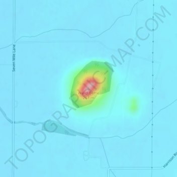
Name: Ward Butte topographic map, elevation, terrain.

Location: Ward Butte, Linn County, Oregon, United States (44.46868 -123.02320 44.46878 -123.02310)

Average elevation: 292 ft

Minimum elevation: 262 ft

Maximum elevation: 817 ft

Linn County trails, hiking, mountain biking, running and outdoor activities

Other topographic maps

Click on a map to view its topography, its elevation and its terrain.

Menagerie Wilderness

United States > Oregon > Linn County

Average elevation: 2,687 ft

Tangent

United States > Oregon > Linn County

Average elevation: 246 ft

Brownsville

United States > Oregon > Linn County

Average elevation: 381 ft

Millersburg

United States > Oregon > Linn County

Average elevation: 240 ft

Sodaville

United States > Oregon > Linn County > Sodaville

Average elevation: 551 ft

Gear up for your next adventure:

🥾Women's Hiking Boots - Top-rated trail boots with ankle support and superior grip
❄️Traction Cleats - Prevent slips on icy trails during winter hikes
🪓Survival Multi‑Tool - Versatile tool for camp and trail tasks
🕶️GPS Smartphone Mount - Secure mount for phone navigation
💧Water Filtration Bottles - Safely drink from streams and lakes while exploring

As an Amazon Associate, this site earns from qualifying purchases at no extra cost to you.