
Thank you for supporting this site ❤️
Make a donation
Make a donation
Gear up for your next adventure:
As an Amazon Associate, this site earns from qualifying purchases at no extra cost to you.
Willebroek topographic map
Click on the map to display elevation.
Thank you for supporting this site ❤️
Make a donation
Make a donation
Gear up for your next adventure:
As an Amazon Associate, this site earns from qualifying purchases at no extra cost to you.
About this map
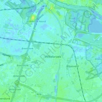
Name: Willebroek topographic map, elevation, terrain.
Location: Willebroek, Mechelen, Antwerp, Flanders, Belgium (51.04095 4.33008 51.08514 4.39179)
Average elevation: 13 ft
Minimum elevation: -46 ft
Maximum elevation: 46 ft
Thank you for supporting this site ❤️
Make a donation
Make a donation
Gear up for your next adventure:
As an Amazon Associate, this site earns from qualifying purchases at no extra cost to you.