
Debdeb topographic map
Interactive map
Click on the map to display elevation.
About this map
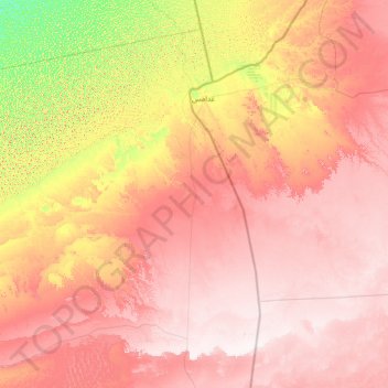
Name: Debdeb topographic map, elevation, terrain.
Location: Debdeb, Daïra d'In Amenas, Illizi, 33200, Algérie (28.46972 7.08631 30.55904 9.90231)
Average elevation: 1,522 ft
Minimum elevation: 623 ft
Maximum elevation: 2,402 ft
Other topographic maps
Click on a map to view its topography, its elevation and its terrain.
In Amenas
Algérie > Illizi > Daïra d'In Amenas
In Amenas, Daïra d'In Amenas, Illizi, 22300, Algérie
Average elevation: 1,831 ft
Bordj Omar Driss
Algérie > Illizi > Daïra d'In Amenas
Bordj Omar Driss, Daïra d'In Amenas, Illizi, 33003, Algérie
Average elevation: 1,444 ft