
Bordj Omar Driss topographic map
Interactive map
Click on the map to display elevation.
About this map
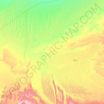
Name: Bordj Omar Driss topographic map, elevation, terrain.
Location: Bordj Omar Driss, Daïra d'In Amenas, Illizi, 33003, Algérie (26.26393 5.63844 30.14219 8.93103)
Average elevation: 1,444 ft
Minimum elevation: 702 ft
Maximum elevation: 4,948 ft
Other topographic maps
Click on a map to view its topography, its elevation and its terrain.
Debdeb
Algérie > Illizi > Daïra d'In Amenas
Debdeb, Daïra d'In Amenas, Illizi, 33200, Algérie
Average elevation: 1,522 ft
In Amenas
Algérie > Illizi > Daïra d'In Amenas
In Amenas, Daïra d'In Amenas, Illizi, 22300, Algérie
Average elevation: 1,831 ft