Geolocate

Winterberg topographic map

Click on the map to display elevation.

Winterberg

Winterberg, gelegen in het Rothaargebergte, deel van het Sauerland, op 500 à 800 meter hoogte boven de zeespiegel, is het vanuit Nederland dichtstbijzijnde Duitse wintersportgebied.

About this map
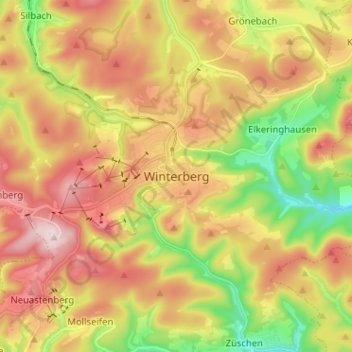
Name: Winterberg topographic map, elevation, terrain.

Location: Winterberg, Hochsauerlandkreis, Noordrijn-Westfalen, 59955, Duitsland (51.15307 8.49385 51.23307 8.57385)

Average elevation: 2,126 ft

Minimum elevation: 1,467 ft

Maximum elevation: 2,769 ft

Gear up for your next adventure:

🦟Ultrasonic Repellers - Create a bug-free zone at your camp or rest stop
🍳Camping Cook Set - Complete cookware for outdoor meals
🏕️Family Camping Gear - Essentials for group camping trips
📚USA Hiking Guide Books - Top trail guides and map books
🏕️Tent Footprint - Protect your tent base from wear

As an Amazon Associate, this site earns from qualifying purchases at no extra cost to you.