
Thank you for supporting this site ❤️
Make a donation
Make a donation
Gear up for your next adventure:
As an Amazon Associate, this site earns from qualifying purchases at no extra cost to you.
Almoinha topographic map
Click on the map to display elevation.
Thank you for supporting this site ❤️
Make a donation
Make a donation
Gear up for your next adventure:
As an Amazon Associate, this site earns from qualifying purchases at no extra cost to you.
About this map
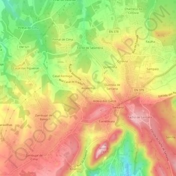
Name: Almoinha topographic map, elevation, terrain.
Location: Almoinha, Castelo, Sesimbra, Setúbal, 2970-271, Portugal (38.44573 -9.13172 38.48573 -9.09172)
Average elevation: 466 ft
Minimum elevation: 69 ft
Maximum elevation: 764 ft
Thank you for supporting this site ❤️
Make a donation
Make a donation
Gear up for your next adventure:
As an Amazon Associate, this site earns from qualifying purchases at no extra cost to you.