Geolocate

Celanova topographic map

Click on the map to display elevation.

About this map
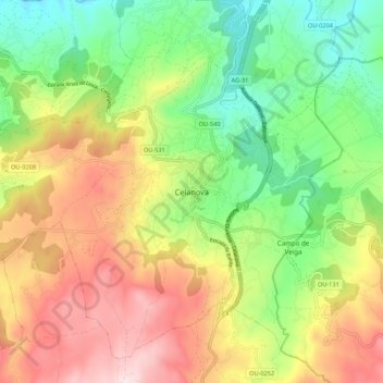
Name: Celanova topographic map, elevation, terrain.

Location: Celanova, Tierra de Celanova, Orense, Galicia, 32800, España (42.11231 -7.99809 42.19231 -7.91809)

Average elevation: 1,870 ft

Minimum elevation: 997 ft

Maximum elevation: 2,989 ft

Gear up for your next adventure:

🧤Tactile Hiking Gloves - Keep hands warm while operating GPS and smartphone screens
🥇GPS Hiking Watch - Multi‑sport GPS watch with navigation and trail tracking
🧯Emergency Survival Kit - All‑in‑one survival essentials for the backcountry
🥾Hiking Shoes - Durable and comfortable shoes for trail hiking
🌄Hiking Binoculars - Compact binoculars for scenic views and trail spotting

As an Amazon Associate, this site earns from qualifying purchases at no extra cost to you.