
Germane topographic map
Click on the map to display elevation.
About this map
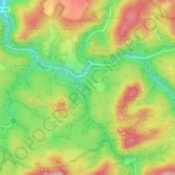
Name: Germane topographic map, elevation, terrain.
Average elevation: 938 ft
Minimum elevation: 600 ft
Maximum elevation: 1,293 ft
Other topographic maps
Click on a map to view its topography, its elevation and its terrain.
Hinterhermsdorf
Germany > Saxony > Sächsische Schweiz-Osterzgebirge > Sebnitz
Average elevation: 1,184 ft