Geolocate

Bison topographic map

Click on the map to display elevation.

About this map

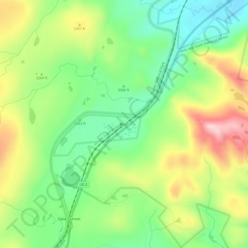
Name: Bison topographic map, elevation, terrain.

Location: Bison, Glacier County, Montana, United States (48.36719 -113.28620 48.40719 -113.24620)

Average elevation: 5,174 ft

Minimum elevation: 4,803 ft

Maximum elevation: 5,719 ft

Glacier County trails, hiking, mountain biking, running and outdoor activities

Gear up for your next adventure:

🪶Thermal Camp Blanket - Extra warmth for cold nights
📶Satellite Messenger - Communication device off‑grid
Solar GPS Watches - Advanced multisport watches with built-in topographic maps
🦺Reflective Outdoor Gear - Safety gear for low‑light conditions
🛰️Handheld GPS Units - Professional satellite navigators for precise backcountry mapping

As an Amazon Associate, this site earns from qualifying purchases at no extra cost to you.