
Thank you for supporting this site ❤️
Make a donation
Make a donation
Gear up for your next adventure:
As an Amazon Associate, this site earns from qualifying purchases at no extra cost to you.
Tlaltenango topographic map
Click on the map to display elevation.
Thank you for supporting this site ❤️
Make a donation
Make a donation
Gear up for your next adventure:
As an Amazon Associate, this site earns from qualifying purchases at no extra cost to you.
About this map
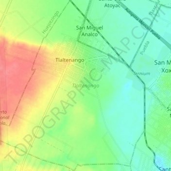
Name: Tlaltenango topographic map, elevation, terrain.
Location: Tlaltenango, Puebla, Mexico (19.13313 -98.37456 19.19201 -98.31817)
Average elevation: 7,234 ft
Minimum elevation: 7,149 ft
Maximum elevation: 7,365 ft
Thank you for supporting this site ❤️
Make a donation
Make a donation
Gear up for your next adventure:
As an Amazon Associate, this site earns from qualifying purchases at no extra cost to you.