Geolocate

Check topographic map

Interactive map

Click on the map to display elevation.

About this map

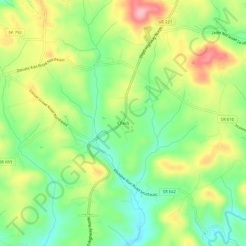
Name: Check topographic map, elevation, terrain.

Location: Check, Floyd County, Virginia, 24079, United States (37.01490 -80.18510 37.05490 -80.14510)

Average elevation: 2,635 ft

Minimum elevation: 2,428 ft

Maximum elevation: 2,910 ft

Other topographic maps

Click on a map to view its topography, its elevation and its terrain.

Indian Valley

United States > Virginia > Floyd County

Indian Valley, Floyd County, Virginia, 24105, United States

Average elevation: 2,608 ft

Chestnut Creek Wetlands State Natural Area Preserve

United States > Virginia > Floyd County

Chestnut Creek Wetlands State Natural Area Preserve, Floyd County, Virginia, United States

Average elevation: 2,953 ft

Willis

United States > Virginia > Floyd County

Willis, Floyd County, Virginia, 24380, United States

Average elevation: 2,861 ft

Floyd

United States > Virginia > Floyd County > Floyd

Floyd, Floyd County, Virginia, United States

Average elevation: 2,444 ft

Haycock

United States > Virginia > Floyd County

Haycock, Floyd County, Virginia, United States

Average elevation: 2,608 ft

Goose Creek

United States > Virginia > Floyd County

Goose Creek, Floyd County, Virginia, 24072, United States

Average elevation: 2,136 ft