Geolocate

Fujie topographic map

Click on the map to display elevation.

About this map

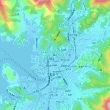
Name: Fujie topographic map, elevation, terrain.

Location: Fujie, Uwajima, Ehime Prefecture, 798-8601, Japan (33.21024 132.54173 33.25024 132.58173)

Average elevation: 184 ft

Minimum elevation: -13 ft

Maximum elevation: 1,165 ft

Gear up for your next adventure:

🎒Gear Packing Cubes - Organize your backpack efficiently
🥾Hiking Shoes - Durable and comfortable shoes for trail hiking
🧣Merino Neck Gaiters - Multi-functional headwear for wind and sun protection
🪶Compact Camp Shovel - Folding shovel for campsite tasks
🌄Hiking Binoculars - Compact binoculars for scenic views and trail spotting

As an Amazon Associate, this site earns from qualifying purchases at no extra cost to you.