
Thank you for supporting this site ❤️
Make a donation
Make a donation
Gear up for your next adventure:
As an Amazon Associate, this site earns from qualifying purchases at no extra cost to you.
Flachau topographic map
Click on the map to display elevation.
Thank you for supporting this site ❤️
Make a donation
Make a donation
Gear up for your next adventure:
As an Amazon Associate, this site earns from qualifying purchases at no extra cost to you.
About this map
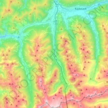
Name: Flachau topographic map, elevation, terrain.
Location: Flachau, Flachauwinkl, Salzburg, 5542, Austria (47.20628 13.34109 47.40014 13.48510)
Average elevation: 4,754 ft
Minimum elevation: 2,477 ft
Maximum elevation: 8,599 ft
Thank you for supporting this site ❤️
Make a donation
Make a donation
Gear up for your next adventure:
As an Amazon Associate, this site earns from qualifying purchases at no extra cost to you.