
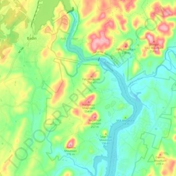
Morrow Mountain State Park topographic map
Interactive map
Click on the map to display elevation.
About this map
Name: Morrow Mountain State Park topographic map, elevation, terrain.
Average elevation: 495 ft
Minimum elevation: 276 ft
Maximum elevation: 892 ft
Morrow Mountain is one of the highest peaks in the Uwharrie Mountains of central North Carolina. When first formed, these mountains rose to nearly 20,000 feet (6,100 m) above sea level, but erosion has gradually worn them down to little more than high hills that average less than 1,000 feet (300 m) in elevation. These pinnacles are the remains of one of the oldest mountain ranges in the eastern United States. The park contains several peaks, of which Morrow Mountain is a high point at 936 feet (285 m).
Other topographic maps
Click on a map to view its topography, its elevation and its terrain.
Greenwood Park
United States > North Carolina > Stanly County > Albemarle
Greenwood Park, Albemarle, Stanly County, North Carolina, United States
Average elevation: 584 ft