Geolocate

Tapis topographic map

Click on the map to display elevation.

About this map

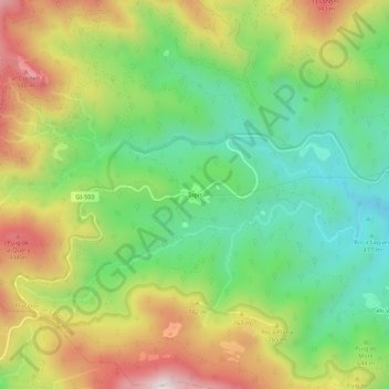
Name: Tapis topographic map, elevation, terrain.

Location: Tapis, Upper Empordà, Girona, Catalonia, Spain (42.36019 2.68132 42.40019 2.72132)

Average elevation: 2,123 ft

Minimum elevation: 1,243 ft

Maximum elevation: 3,363 ft

Gear up for your next adventure:

🪶Trail Camera - Capture wildlife on your hikes
🪶Camping Sleeping Pad - Comfortable sleeping pad for backpacking
🪶Fire Starter Kit - Reliable fire starter for survival and camping
🧺Microfiber Travel Towels - Compact and fast-drying towels for trail use
⛑️Personal Locator Beacon - Safety beacon for emergencies

As an Amazon Associate, this site earns from qualifying purchases at no extra cost to you.