
Thank you for supporting this site ❤️
Make a donation
Make a donation
Gear up for your next adventure:
As an Amazon Associate, this site earns from qualifying purchases at no extra cost to you.
Pals topographic map
Click on the map to display elevation.
Thank you for supporting this site ❤️
Make a donation
Make a donation
Gear up for your next adventure:
As an Amazon Associate, this site earns from qualifying purchases at no extra cost to you.
About this map
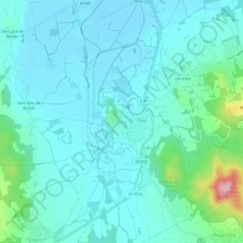
Name: Pals topographic map, elevation, terrain.
Location: Pals, Bas-Ampurdan, Gérone, Catalogne, 17256, Espagne (41.95099 3.12604 41.99099 3.16604)
Average elevation: 112 ft
Minimum elevation: -3 ft
Maximum elevation: 696 ft
Thank you for supporting this site ❤️
Make a donation
Make a donation
Gear up for your next adventure:
As an Amazon Associate, this site earns from qualifying purchases at no extra cost to you.