
Bedford Lake topographic map
Interactive map
Click on the map to display elevation.
About this map
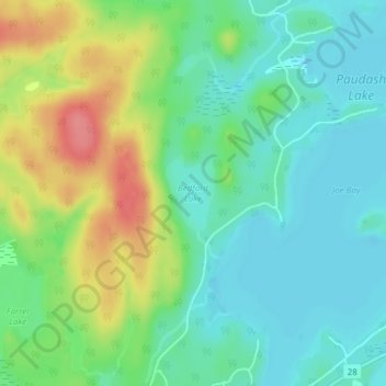
Name: Bedford Lake topographic map, elevation, terrain.
Average elevation: 1,201 ft
Minimum elevation: 1,112 ft
Maximum elevation: 1,375 ft
Other topographic maps
Click on a map to view its topography, its elevation and its terrain.
Lochlin Lake
Canada > Ontario > Haliburton County > Highlands East
Lochlin Lake, Highlands East, Haliburton County, Central Ontario, Ontario, Canada
Average elevation: 1,198 ft