
Thank you for supporting this site ❤️
Make a donation
Make a donation
Gear up for your next adventure:
As an Amazon Associate, this site earns from qualifying purchases at no extra cost to you.
Shirak topographic map
Click on the map to display elevation.
Thank you for supporting this site ❤️
Make a donation
Make a donation
Gear up for your next adventure:
As an Amazon Associate, this site earns from qualifying purchases at no extra cost to you.
About this map
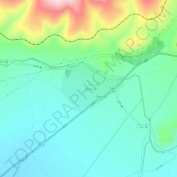
Name: Shirak topographic map, elevation, terrain.
Location: Shirak, Akhuryan region, Shirak Province, Armenia (40.81843 43.89415 40.85843 43.93415)
Average elevation: 5,436 ft
Minimum elevation: 5,164 ft
Maximum elevation: 6,217 ft
Thank you for supporting this site ❤️
Make a donation
Make a donation
Gear up for your next adventure:
As an Amazon Associate, this site earns from qualifying purchases at no extra cost to you.