
Thank you for supporting this site ❤️
Make a donation
Make a donation
Gear up for your next adventure:
As an Amazon Associate, this site earns from qualifying purchases at no extra cost to you.
Rachecourt topographic map
Click on the map to display elevation.
Thank you for supporting this site ❤️
Make a donation
Make a donation
Gear up for your next adventure:
As an Amazon Associate, this site earns from qualifying purchases at no extra cost to you.
About this map
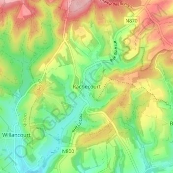
Name: Rachecourt topographic map, elevation, terrain.
Location: Rachecourt, Aubange, Arlon, Luxembourg, Wallonie, 6792, Belgique (49.57031 5.70481 49.61031 5.74481)
Average elevation: 1,007 ft
Minimum elevation: 801 ft
Maximum elevation: 1,286 ft
Thank you for supporting this site ❤️
Make a donation
Make a donation
Gear up for your next adventure:
As an Amazon Associate, this site earns from qualifying purchases at no extra cost to you.
Other topographic maps
Click on a map to view its topography, its elevation and its terrain.