Geolocate

Florence topographic map

Click on the map to display elevation.

About this map

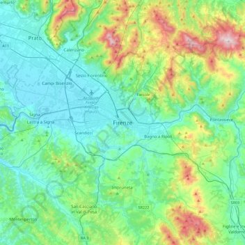
Name: Florence topographic map, elevation, terrain.

Location: Florence, Metropolitan City of Florence, Tuscany, 50100, Italy (43.60987 11.09558 43.92987 11.41558)

Average elevation: 781 ft

Minimum elevation: 98 ft

Maximum elevation: 3,192 ft

Gear up for your next adventure:

🏕️Tent Footprint - Protect your tent base from wear
📻Weather Alert Radios - Stay informed of storm risks while off-the-grid
🛰️Satellite Messengers - Emergency SOS and two-way messaging for off-grid adventures
🥤Water Filter Bottle - All‑in‑one filter bottle for safe hydration
🥘Titanium Cookware - Durable, featherlight pots and pans for backpacking

As an Amazon Associate, this site earns from qualifying purchases at no extra cost to you.