
Thank you for supporting this site ❤️
Make a donation
Make a donation
Gear up for your next adventure:
As an Amazon Associate, this site earns from qualifying purchases at no extra cost to you.
Palombare topographic map
Click on the map to display elevation.
Thank you for supporting this site ❤️
Make a donation
Make a donation
Gear up for your next adventure:
As an Amazon Associate, this site earns from qualifying purchases at no extra cost to you.
About this map
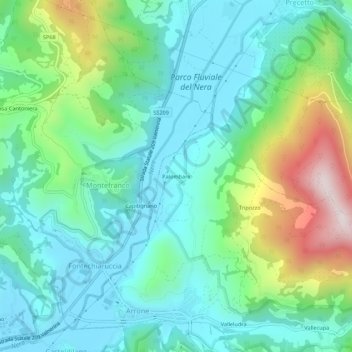
Name: Palombare topographic map, elevation, terrain.
Location: Palombare, Arrone, Terni, Umbria, 05031, Italia (42.57874 12.75583 42.61874 12.79583)
Average elevation: 1,299 ft
Minimum elevation: 719 ft
Maximum elevation: 2,959 ft
Thank you for supporting this site ❤️
Make a donation
Make a donation
Gear up for your next adventure:
As an Amazon Associate, this site earns from qualifying purchases at no extra cost to you.