
黄南藏族自治州 topographic map
Interactive map
Click on the map to display elevation.
About this map
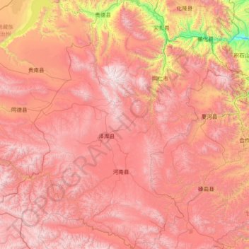
Name: 黄南藏族自治州 topographic map, elevation, terrain.
Location: 黄南藏族自治州, Qinghai, 811599, China (34.08142 100.68755 36.16443 102.44910)
Average elevation: 11,378 ft
Minimum elevation: 5,764 ft
Maximum elevation: 16,375 ft
Other topographic maps
Click on a map to view its topography, its elevation and its terrain.