

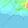
Los Beatos topographic map
Click on the map to display elevation.
About this map

Name: Los Beatos topographic map, elevation, terrain.
Average elevation: 89 ft
Minimum elevation: 46 ft
Maximum elevation: 141 ft
Other topographic maps
Click on a map to view its topography, its elevation and its terrain.

La Alberca
España > Región de Murcia > Campo de Cartagena y Mar Menor > Cartagena
Average elevation: 177 ft

Cabo de Palos
España > Región de Murcia > Campo de Cartagena y Mar Menor > Cartagena
Average elevation: 3 ft

Albujón
España > Región de Murcia > Campo de Cartagena y Mar Menor > Cartagena
Average elevation: 240 ft

La Aljorra
España > Región de Murcia > Campo de Cartagena y Mar Menor > Cartagena > La Aljorra
Average elevation: 276 ft

Playa de los Alemanes
España > Región de Murcia > Campo de Cartagena y Mar Menor > Cartagena
Average elevation: 7 ft

Peña del Águila
España > Región de Murcia > Campo de Cartagena y Mar Menor > Cartagena
Average elevation: 600 ft

Peñarroya
España > Región de Murcia > Campo de Cartagena y Mar Menor > Cartagena
Average elevation: 164 ft

Fatares
España > Región de Murcia > Campo de Cartagena y Mar Menor > Cartagena
Average elevation: 312 ft

Calblanque
España > Región de Murcia > Campo de Cartagena y Mar Menor > Cartagena
Average elevation: 112 ft

Isla del Ciervo
España > Región de Murcia > Campo de Cartagena y Mar Menor > Cartagena
Average elevation: 3 ft

Isla Redonda
España > Región de Murcia > Campo de Cartagena y Mar Menor > Cartagena
Average elevation: 0 ft

Isla del Sujeto
España > Región de Murcia > Campo de Cartagena y Mar Menor > Cartagena
Average elevation: 3 ft

Cabezo Negro de Tallante
España > Región de Murcia > Campo de Cartagena y Mar Menor > Cartagena
Average elevation: 669 ft

Cala Cortina
España > Región de Murcia > Campo de Cartagena y Mar Menor > Cartagena
Average elevation: 115 ft

Garabitos
España > Región de Murcia > Campo de Cartagena y Mar Menor > Cartagena
Average elevation: 846 ft
Cueva del Agua
España > Región de Murcia > Campo de Cartagena y Mar Menor > Cartagena
Average elevation: 89 ft
Cabo de Palos
España > Región de Murcia > Campo de Cartagena y Mar Menor > Cartagena
Average elevation: 3 ft