
Thank you for supporting this site ❤️
Make a donation
Make a donation
Gear up for your next adventure:
As an Amazon Associate, this site earns from qualifying purchases at no extra cost to you.
Rättvik topographic map
Click on the map to display elevation.
Thank you for supporting this site ❤️
Make a donation
Make a donation
Gear up for your next adventure:
As an Amazon Associate, this site earns from qualifying purchases at no extra cost to you.
About this map
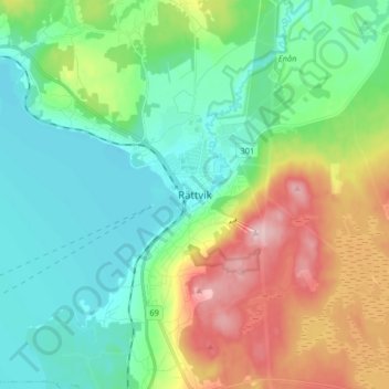
Name: Rättvik topographic map, elevation, terrain.
Location: Rättvik, Rättviks kommun, Dalecarlia, RÄTTVIK, Sweden (60.84375 15.08268 60.92375 15.16268)
Average elevation: 738 ft
Minimum elevation: 518 ft
Maximum elevation: 1,227 ft
Thank you for supporting this site ❤️
Make a donation
Make a donation
Gear up for your next adventure:
As an Amazon Associate, this site earns from qualifying purchases at no extra cost to you.