
芮城县 topographic map
Interactive map
Click on the map to display elevation.
About this map
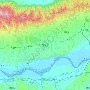
Name: 芮城县 topographic map, elevation, terrain.
Location: 芮城县, 运城市, 山西省, 中国 (34.53666 110.52887 34.85666 110.84887)
Average elevation: 2,077 ft
Minimum elevation: 1,030 ft
Maximum elevation: 6,398 ft
Other topographic maps
Click on a map to view its topography, its elevation and its terrain.