Gîte du Volcan topographic map
Interactive map
Click on the map to display elevation.
About this map
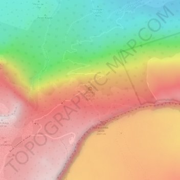
Name: Gîte du Volcan topographic map, elevation, terrain.
Average elevation: 6,978 ft
Minimum elevation: 5,801 ft
Maximum elevation: 7,897 ft

Click on the map to display elevation.
Name: Gîte du Volcan topographic map, elevation, terrain.
Average elevation: 6,978 ft
Minimum elevation: 5,801 ft
Maximum elevation: 7,897 ft