Geolocate

Lacey topographic map

Click on the map to display elevation.

About this map

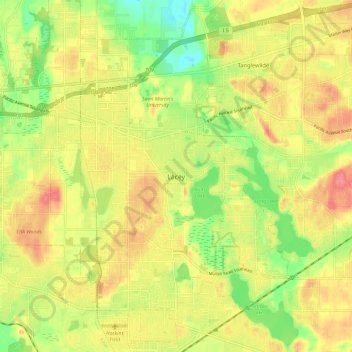
Name: Lacey topographic map, elevation, terrain.

Location: Lacey, Thurston County, Washington, 98503, United States (46.98639 -122.84723 47.06639 -122.76723)

Average elevation: 194 ft

Minimum elevation: 66 ft

Maximum elevation: 305 ft

Thurston County trails, hiking, mountain biking, running and outdoor activities

Gear up for your next adventure:

🧭Pro Hiking Compasses - High-accuracy liquid-filled compasses for topographic orientation
🧤Tactile Hiking Gloves - Keep hands warm while operating GPS and smartphone screens
❄️Traction Cleats - Prevent slips on icy trails during winter hikes
🛡️Insect Repellent - Protection against bugs during outdoor activities
📶Satellite Messenger - Communication device off‑grid

As an Amazon Associate, this site earns from qualifying purchases at no extra cost to you.