Geolocate

Marsden topographic map

Click on the map to display elevation.

About this map

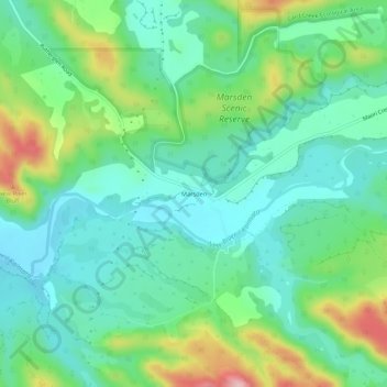
Name: Marsden topographic map, elevation, terrain.

Location: Marsden, Grey District, West Coast, New Zealand (-42.57787 171.19877 -42.53787 171.23877)

Average elevation: 249 ft

Minimum elevation: 56 ft

Maximum elevation: 725 ft

Other topographic maps

Click on a map to view its topography, its elevation and its terrain.

Lake Avernus

New Zealand > West Coast > Grey District

Average elevation: 4,380 ft

Gear up for your next adventure:

🛌Ultralight Sleeping Bags - Compact down bags for cold nights in the wilderness
📦Gear Storage Bags - Organize and protect outdoor equipment
🪶Multi‑Purpose Knife - Useful blade for camp and trail
🧥Waterproof Jacket for Hiking - Breathable and rugged rain jacket for outdoor excursions
🔦LED Headlamp - Bright and durable LED headlamp for night navigation

As an Amazon Associate, this site earns from qualifying purchases at no extra cost to you.