
Thomson topographic map
Click on the map to display elevation.
About this map
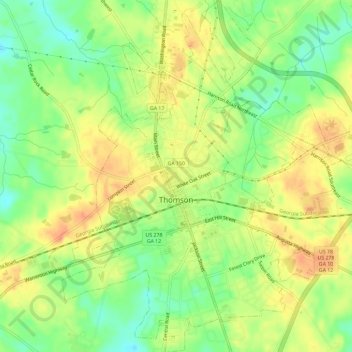
Name: Thomson topographic map, elevation, terrain.
Location: Thomson, McDuffie County, Georgia, 30824, United States (33.44528 -82.51742 33.49390 -82.47119)
Average elevation: 512 ft
Minimum elevation: 433 ft
Maximum elevation: 581 ft
McDuffie County trails, hiking, mountain biking, running and outdoor activities
Other topographic maps
Click on a map to view its topography, its elevation and its terrain.