
City of Essexville topographic map
Interactive map
Click on the map to display elevation.
About this map
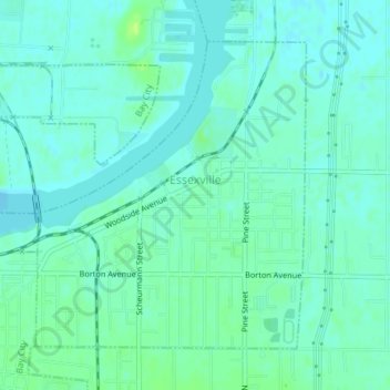
Name: City of Essexville topographic map, elevation, terrain.
Location: City of Essexville, Bay County, Michigan, United States (43.60358 -83.85722 43.62488 -83.83130)
Average elevation: 591 ft
Minimum elevation: 574 ft
Maximum elevation: 617 ft
Other topographic maps
Click on a map to view its topography, its elevation and its terrain.
City of Auburn
United States > Michigan > Bay County
City of Auburn, Bay County, Michigan, United States
Average elevation: 620 ft
Bay City
United States > Michigan > Bay County
Bay City, Bay County, Michigan, 48708, United States
Average elevation: 594 ft