Geolocate

Lecoma topographic map

Click on the map to display elevation.

About this map

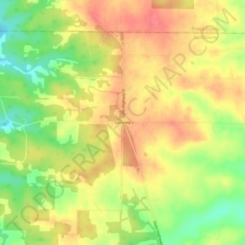
Name: Lecoma topographic map, elevation, terrain.

Location: Lecoma, Dent County, Missouri, 65532, United States (37.75615 -91.75099 37.79615 -91.71099)

Average elevation: 1,148 ft

Minimum elevation: 1,020 ft

Maximum elevation: 1,237 ft

Dent County trails, hiking, mountain biking, running and outdoor activities

Gear up for your next adventure:

🔥Camping Stove - Portable stove for camping and backcountry cooking
🌡️Handheld Weather Meters - Measure wind, temp, and pressure for safe mountain travel
🚪Portable Camp Chair - Foldable chair for comfort at camp
🏫Relief Map Kits - Hands-on tools for teaching landforms and elevation
📚Navigation Handbooks - Master the art of reading topographic maps and using a compass

As an Amazon Associate, this site earns from qualifying purchases at no extra cost to you.