
Thank you for supporting this site ❤️
Make a donation
Make a donation
Gear up for your next adventure:
As an Amazon Associate, this site earns from qualifying purchases at no extra cost to you.
Spies topographic map
Click on the map to display elevation.
Thank you for supporting this site ❤️
Make a donation
Make a donation
Gear up for your next adventure:
As an Amazon Associate, this site earns from qualifying purchases at no extra cost to you.
About this map
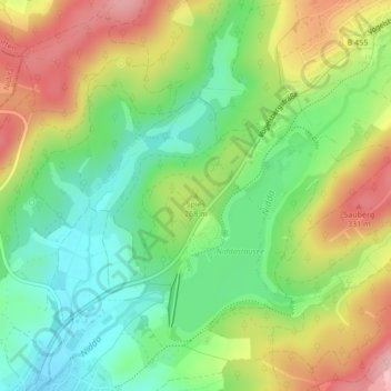
Name: Spies topographic map, elevation, terrain.
Location: Spies, Rainrod, Schotten, Vogelsbergkreis, Hessen, Deutschland (50.48551 9.09610 50.48561 9.09620)
Average elevation: 840 ft
Minimum elevation: 614 ft
Maximum elevation: 1,142 ft
Thank you for supporting this site ❤️
Make a donation
Make a donation
Gear up for your next adventure:
As an Amazon Associate, this site earns from qualifying purchases at no extra cost to you.