Geolocate

Leticia topographic map

Click on the map to display elevation.

About this map

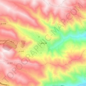
Name: Leticia topographic map, elevation, terrain.

Location: Leticia, La Unión, Tarma, Junín, Perú (-11.41730 -75.79194 -11.33730 -75.71194)

Average elevation: 12,497 ft

Minimum elevation: 10,135 ft

Maximum elevation: 14,012 ft

Gear up for your next adventure:

🧥Waterproof Jacket for Hiking - Breathable and rugged rain jacket for outdoor excursions
🗃️Trail First Aid Kit - Essential kit for outdoor injuries and emergencies
🚪Portable Camp Chair - Foldable chair for comfort at camp
Backpacking Tent - Lightweight and durable tent for multi‑day hikes
🌲Outdoor Survival Books - Best books on survival skills

As an Amazon Associate, this site earns from qualifying purchases at no extra cost to you.