Geolocate

Montviette topographic map

Click on the map to display elevation.

About this map
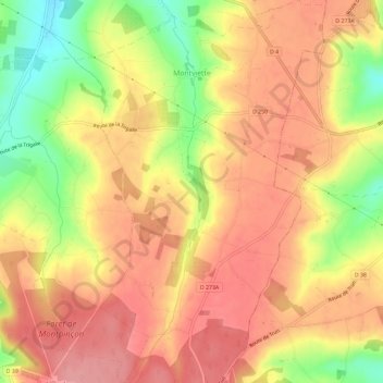
Name: Montviette topographic map, elevation, terrain.

Location: Montviette, Saint-Pierre-en-Auge, Lisieux, Calvados, Normandie, France métropolitaine, 14140, France (48.96893 0.07753 49.00711 0.11552)

Average elevation: 535 ft

Minimum elevation: 312 ft

Maximum elevation: 666 ft

Other topographic maps

Click on a map to view its topography, its elevation and its terrain.

Le Val

France > Normandie > Calvados > Saint-Pierre-en-Auge

Average elevation: 266 ft

Montpinçon

France > Normandie > Calvados > Saint-Pierre-en-Auge

Average elevation: 535 ft

Le Moncel

France > Normandie > Calvados > Saint-Pierre-en-Auge > Vaudeloges

Average elevation: 282 ft

Tôtes

France > Normandie > Calvados > Saint-Pierre-en-Auge

Average elevation: 226 ft

Gear up for your next adventure:

🦺Reflective Outdoor Gear - Safety gear for low‑light conditions
⛑️Personal Locator Beacon - Safety beacon for emergencies
🚁Photography Drones - Capture stunning aerial views of landforms and topography
🔦Powerful Headlamps - Ultra-bright hands-free lighting for night navigation
🔋Rechargeable Batteries - Power up your outdoor devices

As an Amazon Associate, this site earns from qualifying purchases at no extra cost to you.