
Thank you for supporting this site ❤️
Make a donation
Make a donation
Gear up for your next adventure:
As an Amazon Associate, this site earns from qualifying purchases at no extra cost to you.
Marjah topographic map
Click on the map to display elevation.
Thank you for supporting this site ❤️
Make a donation
Make a donation
Gear up for your next adventure:
As an Amazon Associate, this site earns from qualifying purchases at no extra cost to you.
About this map
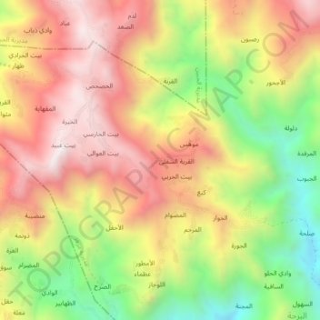
Name: Marjah topographic map, elevation, terrain.
Location: Marjah, Mazhar District, Raymah Governorate, Yemen (14.61704 43.64090 14.65704 43.68090)
Average elevation: 7,428 ft
Minimum elevation: 5,748 ft
Maximum elevation: 8,845 ft
Thank you for supporting this site ❤️
Make a donation
Make a donation
Gear up for your next adventure:
As an Amazon Associate, this site earns from qualifying purchases at no extra cost to you.