
Cornwall topographic map
Click on the map to display elevation.
About this map
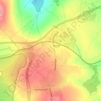
Name: Cornwall topographic map, elevation, terrain.
Location: Cornwall, Roche, Cornwall, England, PL26 8LT, United Kingdom (50.41662 -4.83338 50.41672 -4.83328)
Average elevation: 522 ft
Minimum elevation: 292 ft
Maximum elevation: 679 ft
Other topographic maps
Click on a map to view its topography, its elevation and its terrain.