
Erick topographic map
Click on the map to display elevation.
About this map
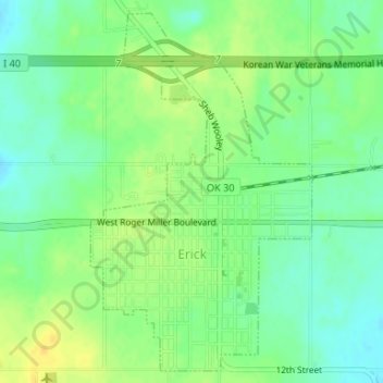
Name: Erick topographic map, elevation, terrain.
Location: Erick, Beckham County, Oklahoma, United States (35.20448 -99.87781 35.22975 -99.85873)
Average elevation: 2,070 ft
Minimum elevation: 2,031 ft
Maximum elevation: 2,110 ft
Beckham County trails, hiking, mountain biking, running and outdoor activities
Other topographic maps
Click on a map to view its topography, its elevation and its terrain.
Sayre
United States > Oklahoma > Beckham County
Sayre is located on the North Fork of the Red River, at an elevation of 1,800 feet (550 m) and 128 miles (206 km) west of Oklahoma City. The area is dominated by low rolling red clay hills.
Average elevation: 1,860 ft