
Walden topographic map
Click on the map to display elevation.
Walden
Walden is the Statutory Town that is the county seat, the most populous community, and the only incorporated municipality in Jackson County, Colorado, United States. It is situated in the center of a large open valley called North Park. People from Walden and the surrounding area refer to themselves as "North Parkers". The town population was 606 at the 2020 census. The town sits at an elevation of 8,099 feet (2,469 meters). It was established in 1889 and was incorporated 2 December 1890. Mark A. Walden, an early postmaster, gave the community his name.
About this map
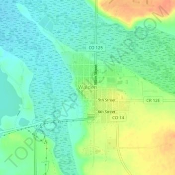
Name: Walden topographic map, elevation, terrain.
Location: Walden, Jackson County, Colorado, United States (40.72605 -106.28693 40.73695 -106.27409)
Average elevation: 8,081 ft
Minimum elevation: 8,028 ft
Maximum elevation: 8,169 ft
Jackson County trails, hiking, mountain biking, running and outdoor activities
Other topographic maps
Click on a map to view its topography, its elevation and its terrain.