Geolocate

Daboka topographic map

Click on the map to display elevation.

Daboka

Dabaka is located at an elevation of 61 m above MSL.

Wikipedia (CC-BY-SA 3.0)

About this map

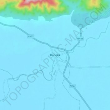
Name: Daboka topographic map, elevation, terrain.

Location: Daboka, Doboka, Nagaon District, Assam, 782440, India (26.07295 92.82588 26.15295 92.90588)

Average elevation: 325 ft

Minimum elevation: 207 ft

Maximum elevation: 2,372 ft

Gear up for your next adventure:

👟Men's Trail Runners - Lightweight footwear for fast-paced exploration and light hiking
🪶Camp Gear Gift Set - Perfect gift bundle for outdoor fans
🛠️Outdoor Gear Repair Kit - Essential tools to fix gear on the trail
🔋Solar Power Banks - Keep your GPS and phone charged in remote wilderness areas
📌Outdoor GPS Map App - Apps and devices for digital topographic navigation

As an Amazon Associate, this site earns from qualifying purchases at no extra cost to you.