Geolocate

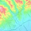
Pinggan River topographic map

Click on the map to display elevation.

About this map

Name: Pinggan River topographic map, elevation, terrain.

Location: Pinggan River, Tungkil, Minglanilla, Cebu, Central Visayas, 6064, Philippines (10.23773 123.80778 10.26190 123.81529)

Average elevation: 52 ft

Minimum elevation: 0 ft

Maximum elevation: 348 ft

Other topographic maps

Click on a map to view its topography, its elevation and its terrain.
Cadulawan

Philippines > Cebu > Minglanilla

Average elevation: 322 ft

Tubod

Philippines > Cebu > Minglanilla

Average elevation: 302 ft

Gear up for your next adventure:

🎁Geography Themed Gifts - Unique gift ideas for map lovers and geography enthusiasts
💧Water Purification System - Clean water on the trail with reliable purifiers
🦟Ultrasonic Repellers - Create a bug-free zone at your camp or rest stop
🔋Rechargeable Batteries - Power up your outdoor devices
🔋Solar Power Banks - Keep your GPS and phone charged in remote wilderness areas

As an Amazon Associate, this site earns from qualifying purchases at no extra cost to you.