Geolocate

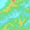
Yi County topographic map

Click on the map to display elevation.

About this map

Name: Yi County topographic map, elevation, terrain.

Location: Yi County, Huangshan, Anhui, China (29.79145 117.64432 30.19528 118.10120)

Average elevation: 1,309 ft

Minimum elevation: 341 ft

Maximum elevation: 5,249 ft

Other topographic maps

Click on a map to view its topography, its elevation and its terrain.

Xiakengcun

China > Anhui > Huangshan

Average elevation: 725 ft

Xidi

China > Anhui > Huangshan

Average elevation: 968 ft

Huangsan Village

China > Anhui > Huangshan

Average elevation: 1,401 ft

Gear up for your next adventure:

🦶Hiking Gaiters - Keep debris and water out of your boots
📷Action Camera - Capture your outdoor adventures in HD
🔦Compact Flashlight - Reliable flashlight for emergencies
🥾Hiking Shoes - Durable and comfortable shoes for trail hiking
🔥Plasma Lighters - Windproof lighters that work in any weather condition

As an Amazon Associate, this site earns from qualifying purchases at no extra cost to you.