Geolocate

Gumpang topographic map

Click on the map to display elevation.

About this map
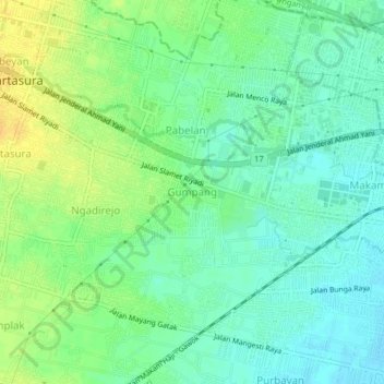
Name: Gumpang topographic map, elevation, terrain.

Location: Gumpang, Sukoharjo, Central Java, 57162, Indonesia (-7.58375 110.73916 -7.54375 110.77916)

Average elevation: 371 ft

Minimum elevation: 335 ft

Maximum elevation: 423 ft

Other topographic maps

Click on a map to view its topography, its elevation and its terrain.

Lapangan Makamhaji

Indonesia > Central Java > Sukoharjo > Gentan > Kuyudan

Average elevation: 341 ft

Tangkisan

Indonesia > Central Java > Sukoharjo

Average elevation: 322 ft

Gear up for your next adventure:

🌄Hiking Binoculars - Compact binoculars for scenic views and trail spotting
🪑Portable Camp Table - Compact table for campsite meals
📷Action Camera - Capture your outdoor adventures in HD
💧Water Purification System - Clean water on the trail with reliable purifiers
🧦Merino Wool Socks - Moisture-wicking, blister-preventing socks for long treks

As an Amazon Associate, this site earns from qualifying purchases at no extra cost to you.