Geolocate

Potton topographic map

Click on the map to display elevation.

About this map
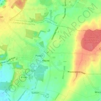
Name: Potton topographic map, elevation, terrain.

Location: Potton, Central Bedfordshire, England, United Kingdom (52.11630 -0.23801 52.14477 -0.16179)

Average elevation: 171 ft

Minimum elevation: 85 ft

Maximum elevation: 279 ft

Gear up for your next adventure:

🚁Photography Drones - Capture stunning aerial views of landforms and topography
🕶️GPS Smartphone Mount - Secure mount for phone navigation
🪶Fire Starter Kit - Reliable fire starter for survival and camping
📚Navigation Handbooks - Master the art of reading topographic maps and using a compass
🏕️Tent Footprint - Protect your tent base from wear

As an Amazon Associate, this site earns from qualifying purchases at no extra cost to you.