
Make a donation
Gear up for your next adventure:
As an Amazon Associate, this site earns from qualifying purchases at no extra cost to you.
Bermuda topographic map
Click on the map to display elevation.
Make a donation
Gear up for your next adventure:
As an Amazon Associate, this site earns from qualifying purchases at no extra cost to you.
Bermuda
Bermuda consists of over 150 limestone islands, but especially five main islands, along the southern margin of the Bermuda Platform, one of three topographic highs found on the Bermuda Pedestal. This Bermuda Pedestal sits atop the Bermuda Rise, a mid-basin swell surrounded by abyssal plains. The Bermuda Pedestal is one of four topographic highs aligned roughly from North-East to South-West. The others, all submerged, being Bowditch Seamount to the North-East, and Challenger Bank and Argus Bank to the South-West. Initial uplift of this rise occurred in the Middle to Late Eocene and concluded by the Late Oligocene, when it subsided below sea level. The volcanic rocks associated with this rise are tholeiitic lavas and intrusive lamprophyre sheets, which form a volcanic basement, on average, 50 m (160 ft) below the island carbonate surface.
Make a donation
Gear up for your next adventure:
As an Amazon Associate, this site earns from qualifying purchases at no extra cost to you.
About this map
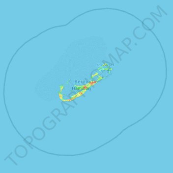
Name: Bermuda topographic map, elevation, terrain.
Location: Bermuda, North Shore Village, Devonshire, DV 04, Bermuda (31.98182 -65.08036 32.62182 -64.44036)
Average elevation: 0 ft
Minimum elevation: 0 ft
Maximum elevation: 223 ft
Make a donation
Gear up for your next adventure:
As an Amazon Associate, this site earns from qualifying purchases at no extra cost to you.