Geolocate

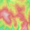
Mehltheuer topographic map

Click on the map to display elevation.

About this map

Name: Mehltheuer topographic map, elevation, terrain.

Location: Mehltheuer, Rosenbach/Vogtland, Vogtlandkreis, Saxony, Germany (50.53484 12.02557 50.55360 12.05332)

Average elevation: 1,644 ft

Minimum elevation: 1,440 ft

Maximum elevation: 1,798 ft

Other topographic maps

Click on a map to view its topography, its elevation and its terrain.

Gippe

Germany > Saxony > Vogtlandkreis > Elsterberg

Average elevation: 1,175 ft

Mühlleithen

Germany > Saxony > Vogtlandkreis > Klingenthal

Average elevation: 2,707 ft

Röthenbach

Germany > Saxony > Vogtlandkreis > Bad Brambach > Hohendorf

Average elevation: 2,103 ft

Gear up for your next adventure:

🕶️GPS Smartphone Mount - Secure mount for phone navigation
🧭Outdoor Navigation Book - Learn advanced navigation skills
👟Trail Running Shoes - Lightweight shoes for trail runners
🍳Camping Cook Set - Complete cookware for outdoor meals
🥾Men's Hiking Boots - Durable, waterproof footwear for rugged terrain and steep inclines

As an Amazon Associate, this site earns from qualifying purchases at no extra cost to you.