Geolocate

Flying J Ranch Park topographic map

Click on the map to display elevation.

About this map

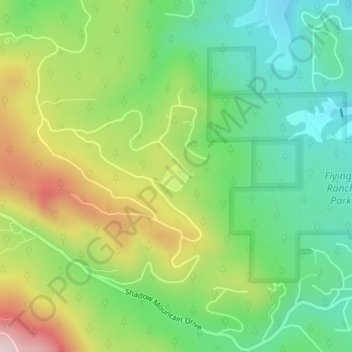
Name: Flying J Ranch Park topographic map, elevation, terrain.

Location: Flying J Ranch Park, Conifer, Jefferson County, Colorado, United States (39.54107 -105.33913 39.54308 -105.33654)

Average elevation: 8,442 ft

Minimum elevation: 7,956 ft

Maximum elevation: 9,236 ft

Jefferson County trails, hiking, mountain biking, running and outdoor activities

Gear up for your next adventure:

🥾Women's Hiking Boots - Top-rated trail boots with ankle support and superior grip
🧭Compass with Lanyard - Easy‑carry compass for navigation
🔊Portable Camp Speaker - Music and alerts at camp
🔥Plasma Lighters - Windproof lighters that work in any weather condition
🧭Outdoor Navigation Book - Learn advanced navigation skills

As an Amazon Associate, this site earns from qualifying purchases at no extra cost to you.