Geolocate

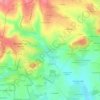
Chanu topographic map

Click on the map to display elevation.

About this map
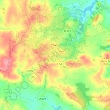
Name: Chanu topographic map, elevation, terrain.

Location: Chanu, Argentan, Orne, Normandy, Metropolitan France, 61800, France (48.70360 -0.70977 48.74464 -0.63684)

Average elevation: 906 ft

Minimum elevation: 751 ft

Maximum elevation: 1,063 ft

Other topographic maps

Click on a map to view its topography, its elevation and its terrain.

Montsort

France > Normandy > Orne > Alençon

Average elevation: 466 ft

Le Buisson Corblin

France > Normandy > Orne > Flers

Average elevation: 774 ft

La Fouquerie

France > Normandy > Orne > Flers

Average elevation: 741 ft

La Mare Jeannot

France > Normandy > Orne > Mantilly

Average elevation: 623 ft

La Haute Folie

France > Normandy > Orne > Saint-Hilaire-la-Gérard

Average elevation: 794 ft

Moissy

France > Normandy > Orne > Gouffern en Auge > Chambois

Average elevation: 364 ft

Gear up for your next adventure:

🔌USB Car Charger - Car charger for on‑the‑go power needs
🪶Paracord Bracelet - Survival bracelet with built‑in tools
🪶Camp Gear Gift Set - Perfect gift bundle for outdoor fans
🧥Men's Rain Shells - Premium waterproof and breathable jackets for mountain weather
🛡️Bear Spray Outdoor - Protection in bear country hikes

As an Amazon Associate, this site earns from qualifying purchases at no extra cost to you.