Geolocate

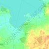
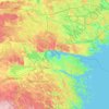
Rappestad topographic map

Click on the map to display elevation.

About this map

Name: Rappestad topographic map, elevation, terrain.

Location: Rappestad, Linköpings kommun, Östergötland County, 583 91, Sweden (58.38145 15.40069 58.42145 15.44069)

Average elevation: 256 ft

Minimum elevation: 217 ft

Maximum elevation: 312 ft

Other topographic maps

Click on a map to view its topography, its elevation and its terrain.
Knabben

Sweden > Östergötland County > Norrköping

Average elevation: 148 ft

Vadstena

Sweden > Östergötland County

Average elevation: 322 ft

Mjölby kommun

Sweden > Östergötland County

Average elevation: 404 ft

Navestad

Sweden > Östergötland County > Norrköping

Average elevation: 112 ft

Nässja

Sweden > Östergötland County

Average elevation: 299 ft

Illern

Sweden > Östergötland County > Linköping

Average elevation: 236 ft

Kinda kommun

Sweden > Östergötland County

Average elevation: 436 ft

Halgen

Sweden > Östergötland County

Average elevation: 289 ft

Linköpings kommun

Sweden > Östergötland County

Average elevation: 325 ft

Gear up for your next adventure:

🌲Outdoor Survival Books - Best books on survival skills
🚑Emergency Bivvies - Heat-reflective sleeping bags for survival situations
🦟Ultrasonic Repellers - Create a bug-free zone at your camp or rest stop
📚Navigation Handbooks - Master the art of reading topographic maps and using a compass
🧭GPS Watch Accessories - Bands and chargers for GPS watches

As an Amazon Associate, this site earns from qualifying purchases at no extra cost to you.