Geolocate

Templeman topographic map

Click on the map to display elevation.

About this map
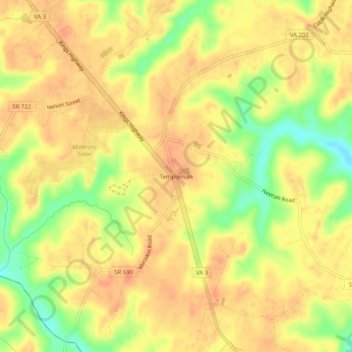
Name: Templeman topographic map, elevation, terrain.

Location: Templeman, Westmoreland County, Virginia, United States (38.05069 -76.79495 38.09069 -76.75495)

Average elevation: 121 ft

Minimum elevation: 23 ft

Maximum elevation: 164 ft

Other topographic maps

Click on a map to view its topography, its elevation and its terrain.
Montross

United States > Virginia > Westmoreland County

Average elevation: 121 ft

Gear up for your next adventure:

🎁Geography Themed Gifts - Unique gift ideas for map lovers and geography enthusiasts
🧯Portable Fire Pit - Compact fire pit for camping spots
📷Action Camera - Capture your outdoor adventures in HD
🔌USB Car Charger - Car charger for on‑the‑go power needs
🚪Portable Camp Chair - Foldable chair for comfort at camp

As an Amazon Associate, this site earns from qualifying purchases at no extra cost to you.