

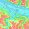
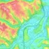
Brackenridge topographic map
Click on the map to display elevation.
Brackenridge
Brackenridge is located at 40°36′30″N 79°44′32″W / 40.60833°N 79.74222°W / 40.60833; -79.74222. The borough's average elevation is 827 feet (252 m) above sea level. According to the U.S. Census Bureau, the borough has a total area of 0.6 square miles (1.6 km2), of which 0.5 square miles (1.3 km2) is land and 0.04 square miles (0.10 km2), or 7.27%, is water.
About this map

Name: Brackenridge topographic map, elevation, terrain.
Average elevation: 873 ft
Minimum elevation: 741 ft
Maximum elevation: 1,158 ft
Allegheny County trails, hiking, mountain biking, running and outdoor activities
Other topographic maps
Click on a map to view its topography, its elevation and its terrain.
New England
United States > Pennsylvania > Allegheny County > West Mifflin
Average elevation: 1,093 ft
Morgan
United States > Pennsylvania > Allegheny County > South Fayette Township
Average elevation: 1,030 ft
Rural Ridge
United States > Pennsylvania > Allegheny County > Indiana Township
Average elevation: 1,079 ft
Cuddy Hill
United States > Pennsylvania > Allegheny County > South Fayette Township
Average elevation: 1,076 ft
Indianola
United States > Pennsylvania > Allegheny County > Indiana Township
Average elevation: 1,014 ft
Rennerdale
United States > Pennsylvania > Allegheny County > Collier Township
Average elevation: 1,053 ft
Noblestown
United States > Pennsylvania > Allegheny County > North Fayette Township
Average elevation: 1,089 ft
Industry
United States > Pennsylvania > Allegheny County > Elizabeth Township
Average elevation: 958 ft
Greenock
United States > Pennsylvania > Allegheny County > Elizabeth Township
Average elevation: 945 ft
Enlow
United States > Pennsylvania > Allegheny County > North Fayette Township
Average elevation: 1,079 ft
Dorseyville
United States > Pennsylvania > Allegheny County > Indiana Township
Average elevation: 1,066 ft
Allison Park
United States > Pennsylvania > Allegheny County > Hampton Township
Average elevation: 1,063 ft
Bairdford
United States > Pennsylvania > Allegheny County > West Deer Township
Average elevation: 1,079 ft
Buena Vista
United States > Pennsylvania > Allegheny County > Elizabeth Township
Average elevation: 955 ft
Beadling
United States > Pennsylvania > Allegheny County > Upper St. Clair
Average elevation: 1,070 ft
Groveton
United States > Pennsylvania > Allegheny County > Robinson Township
Average elevation: 876 ft

Piney Fork
United States > Pennsylvania > Allegheny County > South Park Township
Average elevation: 1,066 ft
Fox Ridge
United States > Pennsylvania > Allegheny County > McCandless > Fox Ridge
Average elevation: 1,145 ft
Black mulberry (Morus nigra)
United States > Pennsylvania > Allegheny County > Pittsburgh
Average elevation: 971 ft
Gibsonia
United States > Pennsylvania > Allegheny County > Richland Township
Average elevation: 1,142 ft
Elfinwild
United States > Pennsylvania > Allegheny County > Shaler Township
Average elevation: 1,056 ft
Wildwood
United States > Pennsylvania > Allegheny County > Hampton Township
Average elevation: 1,079 ft
Panther Hollow Lake
United States > Pennsylvania > Allegheny County > Pittsburgh
Average elevation: 938 ft
Santiago
United States > Pennsylvania > Allegheny County > North Fayette Township
Average elevation: 1,161 ft
Lovedale
United States > Pennsylvania > Allegheny County > Elizabeth Township
Average elevation: 978 ft
Talley Cavey
United States > Pennsylvania > Allegheny County > Hampton Township
Average elevation: 1,119 ft